Winter Storm Fern spreads travel disruption and power outages as it pushes across the U.S.
A sprawling winter storm that began in the Southwest is moving east, triggering emergency declarations, widespread travel delays and growing power outages. Forecasters warned of a long corridor of snow, sleet and freezing rain, with dangerous road conditions and rapidly changing local impacts.
- PUBLISHED
- UPDATED
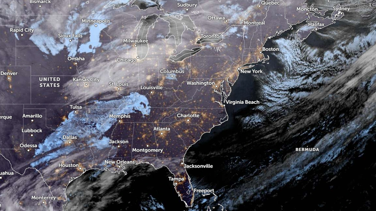
A major winter system—informally dubbed Winter Storm Fern by some outlets—continued to expand its footprint across the United States this weekend, bringing a mix of snow, sleet, and freezing rain to a wide swath of the country. Early impacts were reported in parts of the Four Corners region and the Plains before the storm’s most disruptive conditions began pushing into the Mid-South, Midwest, and onward toward the East Coast.
The storm developed on January 22, 2026, and by January 24 it had already produced notable snowfall totals in multiple states, while ice and sleet created additional hazards that can be harder for road crews to treat. In several communities, the bigger concern was not just accumulation but timing: precipitation types are expected to flip between snow, sleet, and freezing rain over short distances, creating unpredictable driving conditions and the potential for rapid icing on elevated roadways.
Travel disruption mounted quickly. Flight cancellations and delays expanded as the system approached major airport corridors, and highway agencies warned that even short trips could become dangerous when temperatures hover near freezing. Local officials stressed that the combination of winter precipitation and gusty winds can increase the risk of downed tree limbs and power lines—particularly in areas receiving significant ice accretion.
Power outages were reported as the storm strengthened, and communities prepared for the possibility of longer restoration times in places where ice loads were heavy. Emergency managers also urged residents to charge devices early, check on neighbors, and avoid unnecessary travel during periods of peak icing, since even minor incidents can gridlock roads and slow emergency response.
Forecast guidance from federal weather forecasters continued to evolve Sunday as the system advanced. Officials urged the public to follow local National Weather Service statements for the latest on warnings, precipitation timing, and expected impacts, since conditions can vary sharply from one county to the next.
Even for areas that see mostly snow, the storm’s reach matters because the most disruptive effects often come from the intersection of weather and infrastructure: commute windows, school schedules, supply deliveries, and utility restoration. Authorities cautioned that the storm could remain a travel and safety issue beyond the initial band of precipitation, as temperatures stay low and untreated surfaces refreeze overnight.
REPORTING RECORD
- SRC-01WikipediaWikipedia